Total area of Cote d'Ivoire: 322,463 sq. kilometers
Land area of Cote d'Ivoire: 318,003 sq. kilometers
Water area of Cote d'Ivoire: 4,460 sq. kilometers
Size comparative to U.S. Territory: slightly larger than New Mexico.
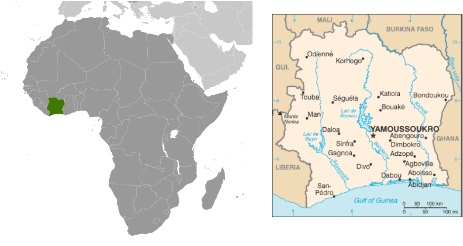
Countries bordering Cote d'Ivoire: Burkina Faso, Ghana, Guinea, Liberia, Mali.
Total distance of all land boundaries: 3,110 kilometers
Total distance of coastline: 515 kilometers
Description of climate: tropical along coast, semiarid in far north; three seasons - warm and dry (November to March), hot and dry (March to May), hot and wet (June to October).
Description of terrain: mostly flat to undulating plains; mountains in northwest.
Point of lowest elevation: Gulf of Guinea (0 meters)
Point of highest elevation: Monts Nimba (1,752 meters)
Land area of Cote d'Ivoire: 318,003 sq. kilometers
Water area of Cote d'Ivoire: 4,460 sq. kilometers
Size comparative to U.S. Territory: slightly larger than New Mexico.
Countries bordering Cote d'Ivoire: Burkina Faso, Ghana, Guinea, Liberia, Mali.
Total distance of all land boundaries: 3,110 kilometers
Total distance of coastline: 515 kilometers
Description of climate: tropical along coast, semiarid in far north; three seasons - warm and dry (November to March), hot and dry (March to May), hot and wet (June to October).
Description of terrain: mostly flat to undulating plains; mountains in northwest.
Point of lowest elevation: Gulf of Guinea (0 meters)
Point of highest elevation: Monts Nimba (1,752 meters)